Trace Wainwright's footsteps on this 13-day trek through the heart of England
The Lake District. The Yorkshire Dales. The North York Moors. This 192 mile trail takes in England’s Greatest Hits and has become the English hikers’ Magnus Opus… but it’s also a riotously fun fortnight of English eccentricity, traversing some of the country’s most beautiful landscapes and charming nooks and crannies.
Some enter into it like marathon runners; there’s talk of PBs and record-attempts. Others amble merrily from pub to pub; there was even one night of bad singing. The trail is a test of endurance, not skill. I encountered people of all ages, genders and continents.
But what’s most telling about the magic of the Coast to Coast is that you’ll meet people doing it again and again and again. Bringing their children, or reuniting with University room-mates decades on, marching in memory of those lost and still missed. It’s a route filled with as many stories as it is with generous honesty boxes of homemade treats and views across hills that will make your heart skip.
I think of this walk often and smile – and still can’t quite believe I managed it.
- Go global: Bucket-list multi-day treks around the world
When to go
This is the north of England – all summer it may rain, a winter’s day can be sunny and crisp. You’ll be blessed with four seasons in any day. But May through to September will give you the best fighting chance, and lovely long daylight hours.
How to get there
This route is so popular you can purchase full on tours and transfers, support vans carrying your bags and packed lunches. Or you can hop the train to St. Bees and a bus at the other end to York or Leeds – and let your feet do everything in between.
I opted for a middle-ground, due to shoulder injury, and paid for my rucksack to be transported to help me over the longest days, then begged my parents to meet me for a pint at the finish.
Get your bags shuttled: Use sherpavan.com or c2cpackhorse.co.uk.
Where to stay
Again, the route’s popularity offers much flexibility here. I met campers carrying all their kit. I met others staying in 4* luxury gastropubs. But the top tip – THE MUST – is book in advance. This route is strictly west to east – everyone going the same way, stopping in the same places.
Pick your pitstops, call the B&Bs, bunkhouses, pubs and barns en route and get organised. Where you end up laying your head is part of the adventure. I sourced most of mine from this pleasingly basic website.
Coast to Coast top tips
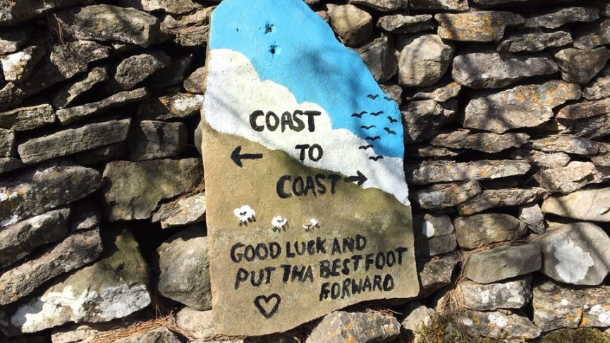
In the Lakes you can guzzle water from streams to stay hydrated. Food is available in the plentiful pretty cafes and honesty boxes made by local children. I took a guide book with OS Maps for support, but the route is mostly well marked by cheery homemade signs. Wainwright’s original guide is good for research – but not for carrying.
Coast to Coast: The route
I heard talk in pubs of people doing the Coast to Coast in 8 days. Many tourists I met were doing it in fifteen. In 1991 an elite runner managed it in 39 hours, 36 minutes and 52 seconds.
That sounded awful to me, so I chose 13 days – largely to fit it in to a fortnight off work – and because of the villages I wanted to visit. There is no official way, nor any right or wrong answer.
St Bees – Cleator Moor – 8 miles
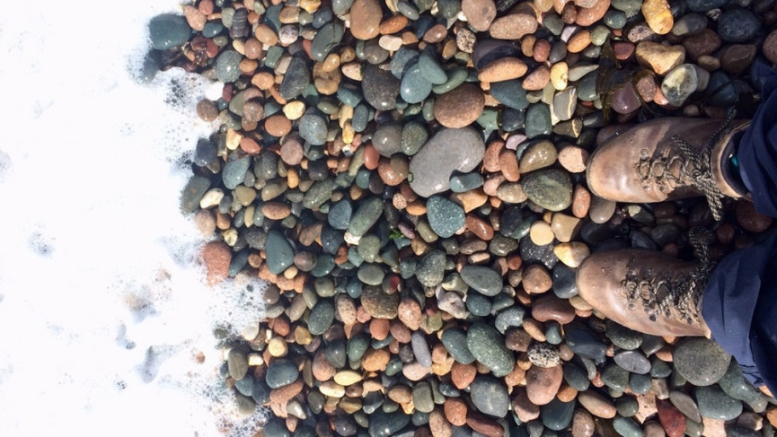
My choices gave me an easy start. The coastal town of St. Bees is host to a crumbling 12th Century Abbey, a fancy Elizabethan school and a sweeping shingle beach, where you absolutely must dip your bare toes before setting off. You’ll repeat this ritual on the other side in a few days.
Then it’s off up a gentle cliff path lined with bright yellow gorse, past a lighthouse then zig-zagging inland through villages and kissing-gates to meadows.
This is real Cumbria – not the postcard perfect cottages of the National Park, but instead the homes of those working in the nearby nuclear plant Sellafield and the Georgian market town of Whitehaven.
Once home to coalminers in the 1800s, the economy has wobbled since. Walkers are welcomed with open-arms – extending tourism beyond the park boundaries.
I took a train up to St. Bees – it’s an easy and regular connection from Carlisle – so set off at lunchtime for this first half day. Most walkers would press on to Ennerdale Bridge – another five miles – but I wanted to stay in England’s Most Remote Hostel, Black Sail. So this was a mere warm up.
Friendly, reasonable B&B: jasminehousebandb.com
Cleator – Black Sail – 14 miles
A drizzly start – and the first real challenge. This day begins straight up steep Dent Fell between dark fir trees. Once out on the moors, on a clear day, you’ll see the stunning Lakeland stretch out before you before dropping steeply to Nannycatch Beck, to hop boggy sheep fields to Ennerdale, and your first Lake of the Lakes that supplies 60,000 nearby homes with water.
You’ve two options – and I regretted my choice. The North shore is a well-marked but busy path through Bowness plantation. The South is the preferred choice of ‘real’ Coast-to-Coasters – a treacherous and slippy craggy scramble in the rain.
It did not cease to pour the entire day for me, but I am assured that this area and the subsequent forest is typically ablaze with wildlife; woodpeckers, goldcrests – perhaps even a pine marten.
I trudged on, head down and dripping, but Black Sail hostel was worth it. This former shepherds’ hut only sleeps 16, and they’ll cook you dinner inside the cosy woodsmoke quarters. A sheep tottered into our dorm at night and I ate my breakfast outside with a woolly black cow.
Excellent accommodation: yha.org.uk/hostel/yha-black-sail
Black Sail – Grasmere – 18 miles
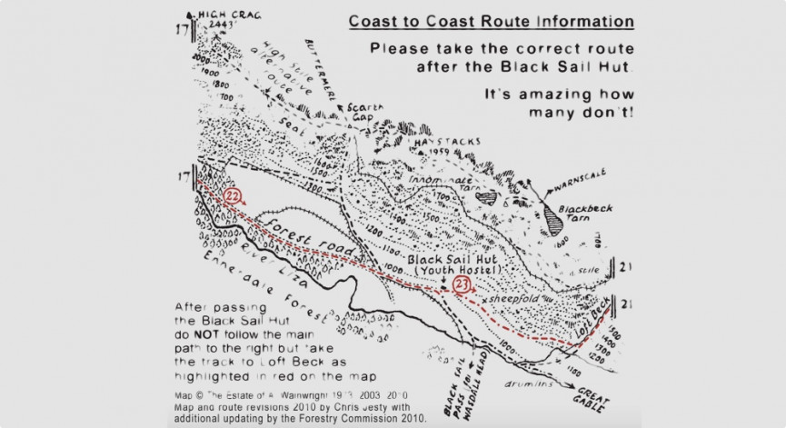
Today you’ll need your compass and your wits about you. Beginning with the ascent of Loft Beck out onto the crags. Behind you, beautiful Buttermere melts away and Borrowdale unfolds below.
Now it’s important to take the right path here – and Mountain Rescue has been repeatedly called out to walkers that have taken the wrong path.
“After passing the Black Sail hut do not follow the main path to the right but take the track to Loft Beck as highlighted on this map“.
I found navigating challenging in the misty morning; only the tramway of a former slate mine helps you keep your bearings… if you can see it. A trilogy of Lakeland villages follow, with plenty of chance to grab snacks in Seatoller, Rosthwaite and Stonethwaite.
And boy you’ll need them because the next steady climb up Greenup Edge felt never-ending and can be treacherous in icy conditions. Cairns mark your route across the Grasemere Common, boggy and filled with little waterfalls tumbling through the starry saxifrage. The descent took its toll on my knees after such a day of climbing; I reached Grasmere at gone 8pm – too late to buy its famous gingerbread and a little shell-shocked by the bustle of summer tourism.
Basic, overpriced accommodation: hyha.org.uk/hostel/yha-grasmere-butharlyp-howe
Grasmere – Patterdale – 9 miles
Today’s shorter stretch means you’ve time to enjoy Grasmere’s charms; Dove Cottage was Wordsworth’s home and its plentiful shops help you restock. It also meant a gentler day for walk-weary limbs. That said, it’s another fierce climb up the brilliantly named Tongue Gill – there are two paths, and I found the right-hand side much safer.
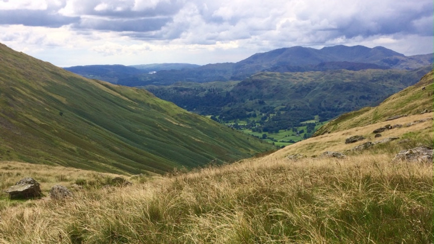
The view back into the valley makes a perfect picnic stop, safe in the knowledge it’s all downhill from here along the Griesdale Pass. I encountered not one, but two, incredible hikers who’d hopped off up Helvellyn, as if it were some mere add-on rather than the most spectacular and windswept mountain in Cumbria.
I collapsed into my farmhouse bunkbed exhausted; day four is when I began to feel the impact on my body and opted, for the next four days, to have my large rucksack transported – locals recommended Sherpavan and Packhorse. It was worth every penny of the £9 a day fee.
Excellent accommodation: noranbankfarm.co.uk/shepherd-s-crook-bunkhouse
Patterdale – Shap – 15 miles
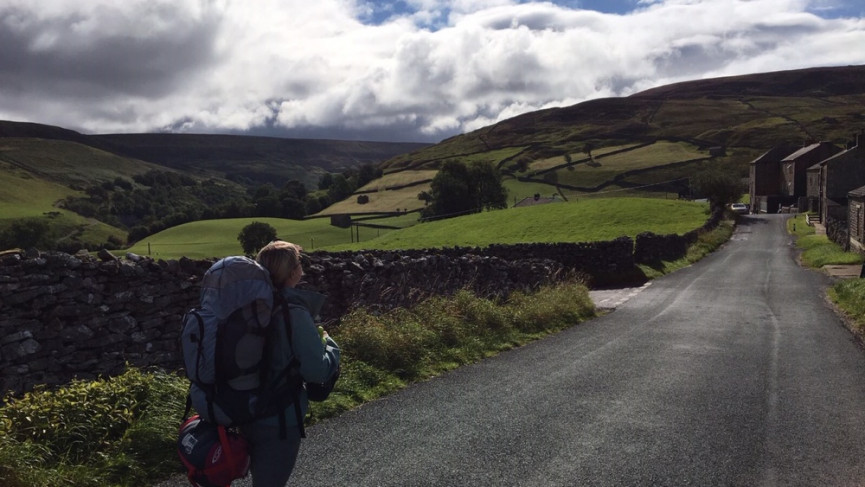
Relieved of my bag and refreshed by deep sleep, this section marks a real highlight of the entire trail, the highest peak of the journey and leaving the slate and drama of the Lake District for the lush farmland undulations of rural Cumbria.
You set off upward, again, past the adorable Angle Tarn dotted with geese, with sweeping views of Ullswater – England’s longest lake – as you stride out towards The Knott marked by a tall cairn. South of here runs The High Street; no shops, but the route once taken by Romans crossing these hills.
But you’re heading west along the satisfying sweep of Kidsty Pike – at its end you’ve topped 780m – and you’ll see its form on the horizon behind you for days to come. Dropping down to Haweswater Reservoir is hard on the knees and following its wooded shore felt punishing. Below the surface, flooded villages lurk.
That’s when I found my first honesty box – a little wooden chest filled with sugary pop and chocolate, just leave the right coins and a heap of gratitude. The change of scenery is instant as you cross farm fields dotted with Coast to Coast waymarkers, before, finally, the ruins of Shap’s 11th century Abbey loom into view. You could go take a look inside… or like me, stumble instead to the pub.
Great grub and basic beds: newinglodge.co.uk
Shap – Kirkby Stephen – 20 miles
After days of peace, today you’ll cross one of the country’s busiest motorways; the roar of traffic an assault from beneath the footbridge.
There’s a cement works and a quarry to give you a reality check, too. But beneath your feet is limestone, which makes this a special habitat, filled with vulnerable plant life. Walkers are expected to carefully stick to the trail, which although long, is easy in gradient.
It was on this day I fell into step with a fellow Coast to Coaster, and the miles and hours passed quickly as we talked; a blessing, as there is limited excitement on this stretch.
Kirkby Stephen was once the preferred stop-off for British families and couples travelling to see Blackpool’s famous illuminations. Now it’s the Coast to Coast bringing in visitors. The chip shops are exceptional.
Creepy hostel in a church: kirkbystephenhostel.co.uk
Kirkby Stephen – Keld – 15 miles
You leave the village along a metalled path, past farm fields and even alpacas. Today’s headline act is the Nine Standards, curious towers of drystone walling – some short and fat, others tall and shapely. No one seems to know what on earth they’re for.
There are two recommended routes to reach them – one drier and easier, allegedly. But when I took that way in August, we sank and couldn’t see the stones for damp mist. This disappointment was recovered swiftly by realising I’d crossed into Yorkshire and the halfway mark, and celebrated with a Scotch egg as we trudged on through peat bogs, grouse butts and heather. I would’ve whinged louder, had I not encountered an incredible family with six children, all cheerfully doing the walk for charity. Soon you’ll drop off the moors to Swaledale – truly one of the most gorgeous corners of England.
This campsite rented me a pitch and tent – plus served exceptional home cooking: swaledaleyurts.com
Keld – Reeth – 11 miles
Your phone won’t work for vast patches of the route. But Keld is definitely the worst. And so it was not the ideal spot to arrange to meet a friend. But we found each other, I got my first cuddle in a week and impeccable company to lift my spirits over this weekend. You’re never really alone on the Coast to Coast. But company really helps.
In blistering full sunshine we set out along the river Swale, stopping to dip our toes in its icy ripples as we leaned our packs on the numerous abandoned lead mine huts. The remains of smelters and shelters mark a time when thousands lived in this little valley. Today it’s almost empty.
We climbed easily up onto the moors, crossing streams and dodging sheep, before finishing the day happily in the dappled sunlight path that leads to Reeth. By now, I knew a clutch of walkers, and my friend and I joined our new gang for a ‘big’ night out in the pub. A live band, some table dancing, and even shooting stars to mark our walk home made for the perfect night.
Comfy cosy hospitality here: hackneyhousereeth.co.uk
Reeth – Brompton-on-Swale – 13 miles
The river Swale will be your guide today, in sight as you pass old priories where ladies of court hid from the amorous advances of Henry VIII, climb steps lined with blackberries once picked by nuns before leaving it briefly to pass through Markse.
Nip into the Church if you’ve time, not least for the snacks but also a seat amongst the flower-filled graveyard. Then it’s back to the river to pass through Applegarth’s many farms and woodlands, before dropping steadily into the Georgian grandeur and castle battlements in Richmond. It was around now I realised I’d hit my stride, walking easily and at pace, ending my days content not exhausted.
I extended my day out of Richmond to make reaching my next target easier. But my basic accommodation in Brompton was amongst the worst ever endured. Do not stay here unless you have to: https://independenthostels.co.uk/members/bromptononswalebunkbarn/
Brompton-on-Swale – Ingleby Cross – 22 miles
I started today at first light, wishing to evacuate from the basic bunk barn as quick as I could. And a poor night’s kip, combined with a hot summer’s day, rendered this very long stretch arduous. It was flat. There’s a lot of wheat fields and hard farm tracks. Plus crossing of A-roads and railways.
I missed the satisfaction of a mountain, the variation of the Dales. My feet missed the cushion of grass. But it’s just one day, and I smashed through some podcasts and cracked on.
I remember very little of the day, aside from the crushing disappointment that the pub in Danby Wiske was closed and eating two ice creams greedily when I finally reached Ingleby. I arrived at my accommodation so red-faced and burned out the lovely landlady immediately poured me a large glass of pinot grigio without asking. “They often look like you by this point,” she said.
Flawless hospitality and wine: parkhousecountryguesthouse.com
Ingleby Cross – Clay Bank Top – 11 miles
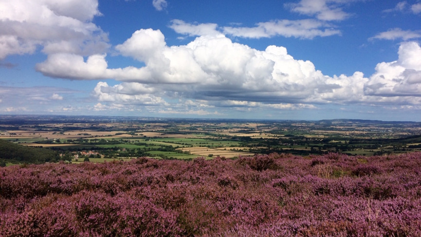
And like that, it’s over. We’re back in the glorious countryside and heading to the North York Moors. I was surrounded by chattering grouse as I set out in Arncliffe woods, passed TV masts and looking back east at all the land I’d crossed.
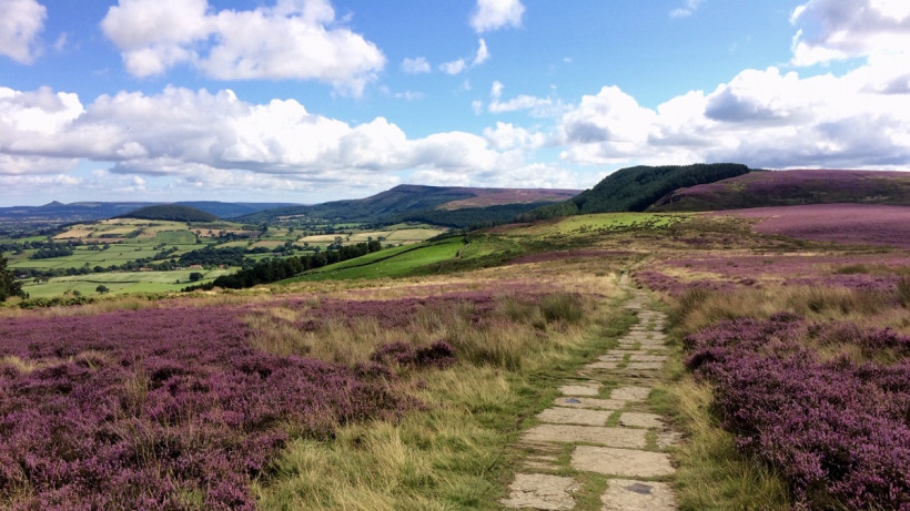
Suddenly I was out amongst purple heather beneath fluffy white clouds – and your first glimpse of the coast up at Teesside ahead. Tantalisingly you’re nearing the end. A series of steady switchbacks through woodlands make today pacey and varied as you join a stretch of the Cleveland Way busy with dog walkers and families.
There’s even a cracking café halfway. The final stretch of moor is tougher, bleaker and requires a little scrambling. There’s no village nor accommodation here – but most pubs offering a bed will also offer you a pick up and drop off service from the B1257 road at Clay Bank.
Two giant schnauzers and massive pub portions here: the-buck-inn.co.uk
Clay Bank – Glaisdale – 17 miles
More moors, more grouse, more heather. But you won’t be bored, as you cross this track, once used by mineral miners, as it sweeps across the hills. Not far in, the remote Old Lion Inn delivered a little respite, and some disbelief that a woman was doing the Coast to Coast alone (!). The best place name on your whole route is Great Fryupdale – sadly lacking in sausages – but from the moors above you’ll also clearly spy the North Sea, where tomorrow you’ll be dipping your toes.
Today fatigue returned for me, so this clearly marked stone track was a blessing. A couple of hikers I’d fallen into step with and I were all staying in the same farm barn (bankhousefarmhostel.co.uk) where the owner boasted we could upgrade to an old static caravan where cricket legend Geoff Boycott allegedly fathered an illegitimate child, but we politely declined, instead asking for a lift into the village for a few pints and a massive feed before the day ahead.
Glaisdale – Robin Hoods Bay – 19 miles
There is little rush like waking up knowing you’re near the finish line. And it was a real treat to do so with fellow Coast to Coasters. We bounced out of bed, along the Esk Valley, making it to untouched Grosmont in time to see the heritage steam train hiss and bellow in the station amongst the multi-coloured cottages and hanging baskets.
We sat smiling with our breakfast butties as a herd of grannies and grandads hopped on board and wished us well. And our spirits stayed high as the moorland melted away and instead caravan parks and salty seaside air began to envelope us.
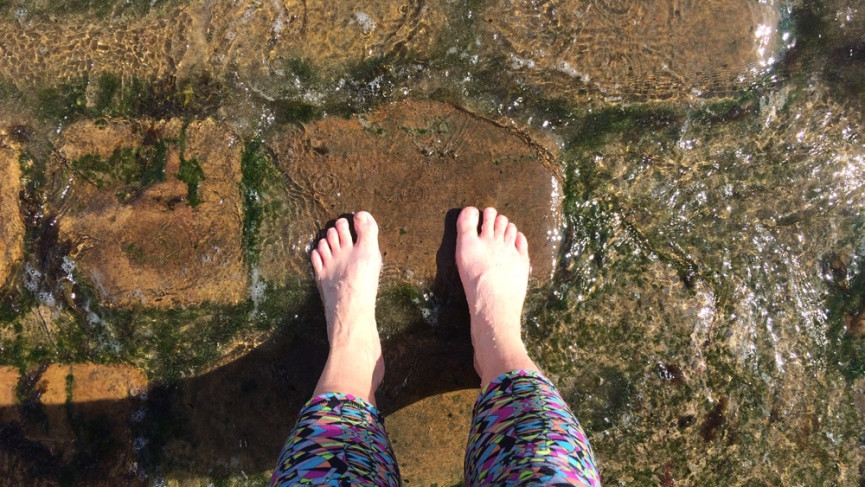
The final four miles outside Hawkser take you right out on the cliff edge – a little cruel as your legs tire – and even crueller is the steep road into Robin Hood’s Bay to Wainwrights Bar. I felt wild with jubilation as I sank my feet beneath the freezing waves and deeply proud as I sat in the sun with a pint. I slept in the back of the car the whole way home.
The walk had been gruelling but great for my body, but the biggest beneficiary was my mind.


