
Covering 330km of Scotland's most remote areas and wildest weather
When it comes to awe-inspiring long-distance walks across the British Isles, there are only a handful with the sort of Odyssean pull as the Cape Wrath Trail in Scotland.
Covering 330km (205 miles), the Cape Wrath Trail twists over Britain’s wild northwest from Fort William to Cape Wrath, the most north-westerly point of the British mainland. There are longer UK trails, but none avoid civilisation to the same extent.
- Essential reading: The best treks in the world
The Cape Wrath Trail takes you to beaches, glens and mountaintops that see very few humans pass by in a year. It goes through ten places that could loosely be termed towns or villages in its entirety, but few of these will coincide with the end of a day’s trekking.
What to expect from the Cape Wrath Trail
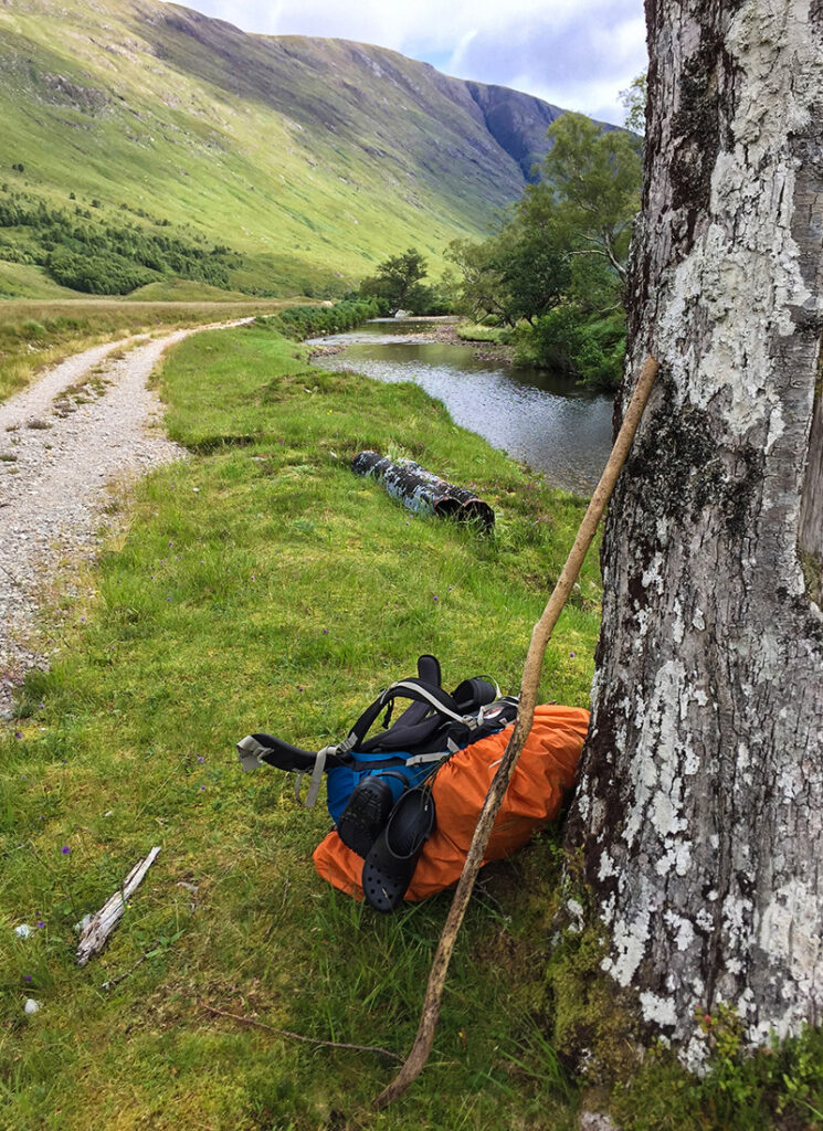
You will need to do this hike with full kit and will need to both camp wild and utilise the wilderness bothies (basic permanent shelters) en route. This, and the fact that the trail is almost totally un-signed, and often not on any discernible path at all, are what make the walk so challenging.
- Essential reading: The complete guide to mountain bothies
It is known as Britain’s toughest long-distance trek – a name we’re not going to argue with. That said, it captures the heart and imagination of the hiker like no other walk in the UK can. Its scenery is lonelier, its weather rougher and, should you complete it, you can truly say that you have taken on the best and worst Britain’s wilderness can hurl at you – and won.
Overview
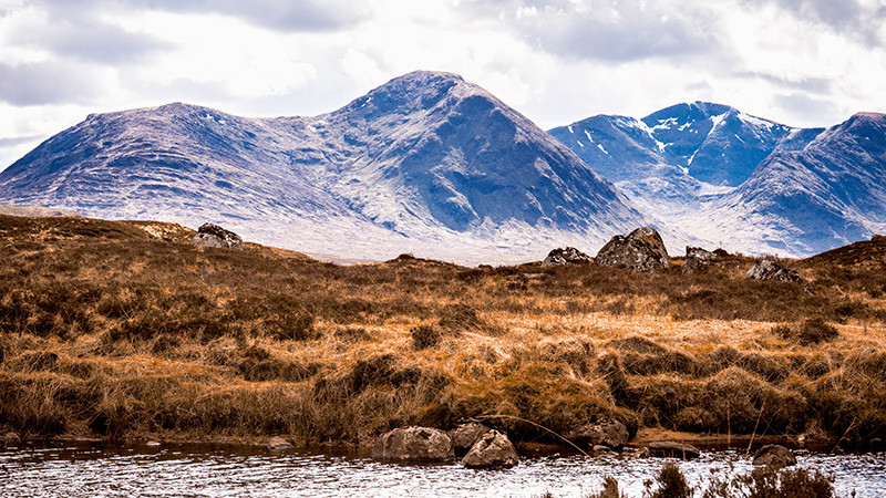
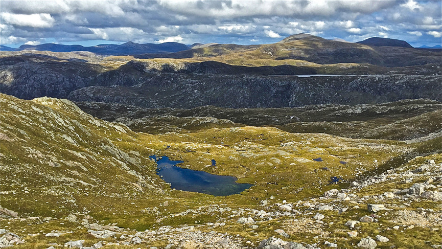
Look at a map of Scotland’s Northwest Highlands and you will struggle to see much human influence at all: few roads, fewer communities. Instead what you see is tract after tract of mountain and moor, rimmed by beaches and riven by lochs. This is the terrain through which the Cape Wrath Trail runs.
The full route is 200 miles, but most hikers need two and a half to three weeks to walk the whole thing. Britain’s wildest weather, which can leave you hiking for days without dry gear, is one thing that slows you down. Another is the fact you have to carry full gear, including a tent, sleeping bag and cooking equipment.
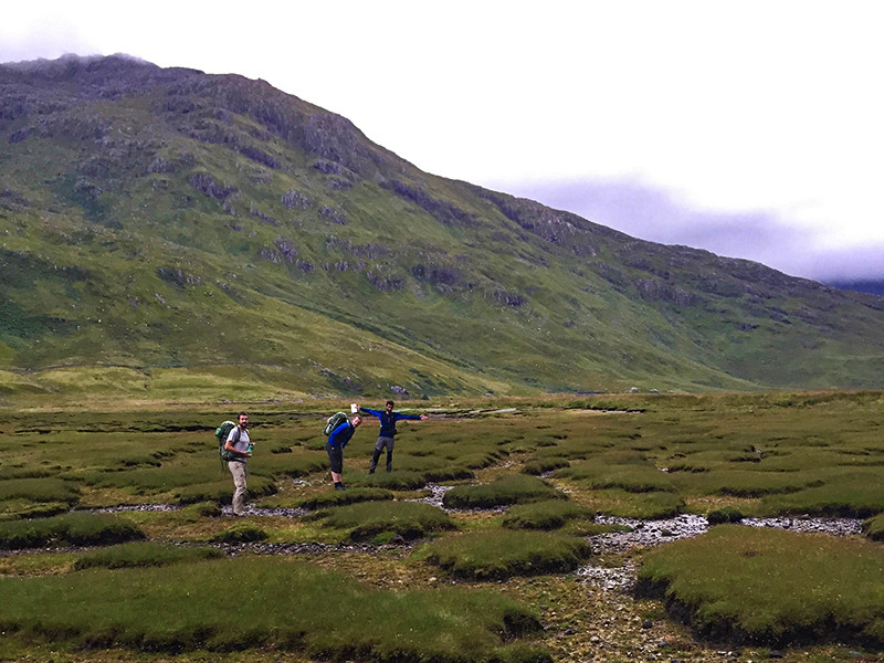
A third thing slowing you down is the fact this is no ordinary path: often nothing more than a compass bearing over moorland or a bog.
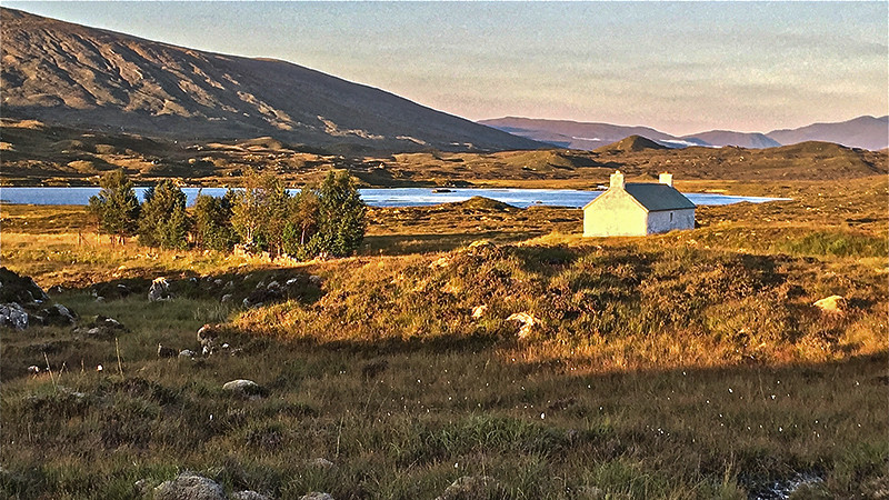
Fort William, the start point, is the best place to get supplies. The only other place en route to stock up is Ullapool, although Shiel Bridge, Kinlochewe and Kinlochbervie also have basic stores, and there are a scattering of other places to get food and find accommodation.
The trail passes many poignant places. Crofthouses and sometimes entire communities abandoned during the Highland clearances, the Glenfinnan viaduct made famous by the Harry Potter movies, and the only UK village not to be connected by road, Inverie.
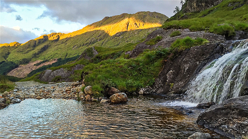
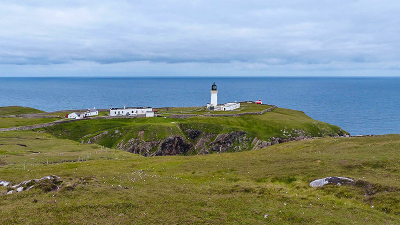
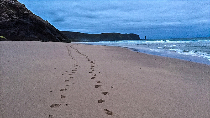
Other than that, the main sights are natural ones: the spectacular geology of Assynt, home to some of the planet’s oldest rocks, Britain’s highest waterfall, Eas a’ Chual Aluinn, and Britain’s remotest beach and highest mainland sea cliffs around Cape Wrath.
Such is the remoteness of the walk that boats are usually necessary to begin and end the hike: the Fort William-Camusnagaul ferry across Loch Linnhe at the start and the bus-boat combo from Cape Wrath across the Kyle of Durness at the finish.
Getting there
Fort William is 3.5 hours by train (three times a day) or 3.25 hours by a slightly more regular bus from Glasgow. Glasgow is connected by train and bus to Edinburgh (one hour) and London (4.5/8 hours). Ferries leave to Camusnagaul from the pier in Fort William five times daily during high season (April-September) and cost around £2.
Route description
This route overview is based on a walking time of 15 days. As the trek is largely dependent on sufficient camping you will need to account for additional days at the end of the hike. If you’re planning to stay in bothies then you will need to modify your route timings.
Day 1: From Camusnagaul follow the lane around Loch Linnhe to Inverscaddle Bay, ascend the first of many glens, Cona Glen and descend to the head of Loch Shiel at Glenfinnan.
Day 2: Traverse Glen Finnan and the spectacular Gleann Cuìrnean to the woodland at Glen Dessary and A Chùil Bothy, then cross moorland to descend to the sea at Loch Nevis and Sourlies Bothy.
Day 3: Follow the beach round to Carnoch and climb Gleann Unndalain, along the edge of the legendary wilderness of Knoydart to Barisdale Bothy.
Day 4: Follow the distinct path east along Loch Hourn to Kinlochhourn, then make the challenging ascent through the wilderness of the Shiel Forest to eventually descend to relative civilisation at Shiel Bridge, with a great setting on Loch Duich.
Day 5: Head along the A87 road for a short distance, then turn off to the pretty hamlet of Morvich. The path rises and falls on one of its loveliest sections through to the thundering Falls of Glomach. There is a tricky descent to Loch na Leitrich, then another long, lonely rise up two glens to Maol Bhuidhe Bothy.
Day 6: A difficult boggy, pathless section before you pass through the moorland of Attadale Forest on decent tracks to Strathcarron.
Day 7: A tough ascent up Fionn Abhainn and over the ridge of Bealach Ban on one of the tougher days of walking. The path descends to the A896 road briefly, then climbs through more challenging rocky mountain country via Coire Dubh Mòr to skirt the slopes of the 1000m-high peaks of Sail Mhor and Ruadh-stac Mòr, framed by mesmeric Loch Coire Mhic Fhearchair. Expert navigation is then required to descend on the correct route to Kinlochewe.
Day 8: It’s then a wonderful moorland ascent to Loch an Sgeireach and over moor to traverse the glen of Abhainn Loch an Nid to Shenavall Bothy.
Day 9: It’s an easier walk the next day via Corrie Hallie and over moorland down to the A835 road at Inverlael.
Day 10: Whether you take the route over the moor or on the road via Ullapool, the route alternatives converge at Loch an Daimh before a long track section through to Oykel Bridge.
Day 11: The path is decent through forest to Loch Ailsh, then pathless for a section on the tough-going ascent and descent through Inchnadamph Forest to the photogenic hamlet of Inchnadamph.
Day 12: A candidate for the most beautiful and barren section of the entire hike follows through the lunar-like landscape of Assynt, via Britain’s highest waterfall Eas a Chùal Aluinn to Glendhu Bothy at the head of Loch Gleann Dubh.
Day 13: The next day of walking is difficult because of the pathlessness and bogginess, via Loch Stack and then Loch a Garbh-bhaid Mòr with a challenging river crossing at Garbh Allt, to Rhiconich.
Day 14: The route then continues on one of its prettiest sections from the road’s end after Kinlochbervie and Oldshoremore to delightfully wild Sandwood Bay, full of rolling dunes and crashing waves.
Day 15: Camp here, and then do the final day’s walking, no more than a few tough pathless hours, over the Parph, the roadless headland on which the Cape Wrath Lighthouse sits.
The options for hiking
As with all linear walks, there are two obvious ways to walk this one: from the most popular start point or from the most popular finish point.
Hiking it from south to north, from Fort William to Cape Wrath, you get the full powerful effects of civilisation slowly fading away, and the solitary lighthouse guarding the jagged cliffs on the Cape Wrath headland at the usual finish point is the most atmospheric end to a trek you could wish for.
Along the route, there are quite a few alternative loops to the main trail, but these all connect up as the way wends north. The Fort William-Shiel Bridge section and, near Inchanadamph, the Loch Ailsh-Glendhu section both have alternative routes which add or subtract a few kilometres depending on what you opt for.
Weather and terrain
Of all the notorious weather of Britain, you can guarantee the Cape Wrath Trail will pass through the most erratic and extreme. Snow is common even in the summer months and blocks of relentless windy wet weather, which take their toll when you are so constantly exposed to the elements, are a near certainty.
The trail rarely climbs above the 600m/2,000 foot mark, but do not let this fool you into thinking the going is easy. On the pathless boggy sections, where under full gear you will be sinking up to your ankles with each step, there is some of the most challenging walking anywhere in this country.
What to know in advance
Come on this hike properly prepared. No matter how you hike this, you will need to spend some nights of the walk wild camping, and several more in the basic wilderness shelters known as bothies where you need your own sleeping mat and bag.
You will have to take the Fort William-Camusnagaul ferry to start the hike by the main route, and a combination of bus, the Kyle of Durness ferry and bus to get back to Durness and onward transportation at the end of the hike.
You will meet fairly few other hikers and pass very few villages or towns in this three-week walk and often you will be more than a day’s hike from the nearest help if you run into difficulty.
What to bring
Bring full kit. This includes a tent, a sleeping bag, survival bags, water purification tablets, provisions for many days, insect repellent, a whistle and (ideally) cooking equipment and GPS. Hiking poles are a very good idea too.
Due to the remote nature of the hike and the limited access to provisions once you’ve started the trek, a great deal of planning needs to take place before setting off. This incorporates carrying enough food to cover you for the trail, packing safety equipment and ensuring you have enough back-up battery power for the journey.
For our full checklist on what to take when going on a trek click here.

What to wear
In such varying terrain (mountainous, moorland, marshy and sandy sections) it is best to pick an all-rounder of a boot that is up to the relentlessly tough conditions but still feels light (you will appreciate the lightness on the marshy bits). Follow these links for our guides to the best options out there: The best hiking boots for men | The best hiking boots for women.
Boots sorted, your biggest worry is over. Mainly now you want something to keep out the wet, which is the most intense weather to deal with on the trail, and secondly the wind, which is the next most intense.
Do not under-estimate how cold the trail can be when camping out or exposed to continued bad weather. This might not be Siberia, but people have died of exposure out here. So wear a base layer and mid-layer which will, above all else, keep you warm along with a light but very waterproof outer layer.
Also, be sure to pack gloves and a hat too and consider investing in a midge/insect net.
Who can do it?
This is no casual weekend ramble. Even experienced walkers often find this difficult, because many are not used to carrying their own kit for three weeks straight over rough, boggy, often pathless terrain.
No technical climbing ability is needed however: the route never even approaches being classed as sheer.
Who to book with
There is no one to book with: this is one for true go-it-alone adventurers where you’ll be either camping or utilising the various bothies on the route. A useful trail guide resource is The Cape Wrath Trail, published by Cicerone, which covers the route in detail.


